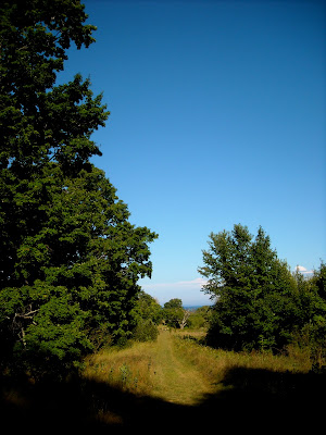
 The Manitou Islands lie about eight miles off the coast of the Lelenau peninsula of Michigan. Both islands were used for timber and small-scale farming. The North Island housed a U.S. Coast Guard Station which is still standing and the South Island provided the best sheltered harbor between Chicago and Machinac. During the late nineteenth century both islands were used as refueling points for steamers. Small communities formed around the lumber camps and docks, but the majority of the island's residents seem to have been homesteaders with anywhere from two to twenty acre farms in secluded areas of the islands. During the 1880's a small resort association of Chicago businessmen grew on the western coast of the North Island where about ten of the cottages can still be seen in ruins. Today both islands are part of the Sleeping Bear Dunes State Park and are designates as wilderness areas.
 While the South Island can be a day trip and provides tours of its lighthouse, beautiful dunes and several campgrounds, the North Island is completely wild except for about twelve acres surrounding the Ranger Station and dock. As soon as you have reached the wilderness area you can camp just about anywhere that is more than 300 ft from the water.
 |
| Historic Fishtown in Leland, where the ferry to the Manitou Islands departs. |
 |
| Traditional fishermen inspect the engine of the Joy, one of Fishtown's two working Michigan "fish tugs." |
 |
| Looking astern in the Manitou Isle, the ancient ferry that serves the North Island. |
 |
| The Ranger Station, Caretaker's cottage and Boathouse from the dock. |
 |
| We camped on the northern end of the island near the John Maleski farm. |
The stars were fantastic on the clear nights, the Milky Way shining through the walls of the tent. We had front row seats for the Perseid meteor shower which was occurring for several of our nights on the island.
 |
| Lunch |
 |
| Blackberries at the Paul Maleski Farm |
 |
| This Painted Turtle was here for the berries as well. |
 |
| Dinner on the third night was exceptional: orzo with dried zucchini, carrots, tomatoes, parmesiano and olive oil. |
 |
| A massive ant nest. |


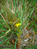
Some of the local flora.
 |
| Lake Manitou is a surprisingly large lake in the very center of the island. |
On our fourth day on the island I took my fishing rod on the two-mile ordeal through mosquito infested forest and swamp leading to Lake Manitou. I had hiked over to the lake two days earlier and talked to a fisherman who said he had been catching 20-30 18+ inch smallmouth. Looking at the map I had imagined Lake Manitou would be more of a small pond surrounded by swamp, when in fact, the lake is quite large. The bottom runs out shallow a good forty to fifty feet and then abruptly drops off. My fly rod and floating line proved itself incapable of reaching the trophy bass which apparently wait in the cool about thirty feet down.
 |
| One of the few people I saw on the island. |
 |
| The water is unbelievably clear. |
 |
| A freshwater muscle in the soft silt that surrounds the lake. |
 |
| All that remains of one of the biggest farms on the island. |
 |
| Walking down from Swenson's farm to the Ranger Station. |
 |
| The beautiful shingle barn now used by the Ranger Station. |
 |
| An amazingly cow-like combine. |
 |
| Coast Guard patrolling the beach on a rather interesting looking machine. I wonder if the Vintagent could identify it from this snapshot. |
 |
| Coast Guard Station next to the Boathouse. |
 |
| The Boathouse |
 |
| This is the original Beebe-McLellan Surfboat from the Island. |
The Story of the Surfboat is too amazing not to repeat here. Apparently, "oar and wind driven surfboats were used by the U.S Coast Guard Life-Saving Service prior to the introduction of motorized lifesaving craft. The Beebe-McLellan type surfboats were self-bailing, had sealed air compartments, a water ballast tank, a centerboard and could carry a sail rig. This is the only known original boat of this type and is believed to have once been assigned to the North Manitou Island U.S. Life-Saving Station. The boat was constructed in 1908. A girl's camp on Elk Lake acquired the boat in the early 1920's and it sailed until the mid-1950's when it was placed on a cradle, a roof added, the self-bailing and ballast tanks removed, to become a playhouse Noah's Ark. A fully rigged reproduction Beebe-McLellan Surfboat is on display at the Sleeping Bear Point U.S. Life-Saving Station Maritime Museum at Glen Haven, Michigan." A rather appropriate use for a lifeboat...
 |
| A last view of the island from the ferry. |
 |
| The return voyage was extremely choppy with six foot swells. Several people were seasick. |


Wonderful photos! I will return and look at this whole post more closely.
ReplyDeleteI was one of the very fortunate few that lived on the island year round and was one of the last people to leave before the govt took it from private ownership.
ReplyDeleteMy Grandmother was born and spent much of her young life on North Manitou and had many fond memories. AS the above poster said, the govt took it from private ownership, basically stole it it if you ask me. They took advantage of the undereducated immigrants who had settled there. and gave them pennies on the dollar for the value of the land. I believe My Grandmas Dad got $4500.00 for the Maleski farm Homestead and fishing camp. I know my Great Great Grandfather Adam Maleski is buried on that land, as is his brother Frank, But there is no Mention Where My Great Great Grandmother Mary is Buried. I hope to get there soon and go through the cemetery and see if there are any Maleskis buried there. My Grandmother was the Youngest child of Paul and Josephine Maleski, Patricia.
DeleteWhere did you live on the island?
ReplyDeleteThank u for this. One of the few pics on all of the internet to show Lake Manitou. I often look at google maps in places that pulls me in, then I investigate to see if it is worth the trip. U sold me on a trip there. Thank u !
ReplyDelete